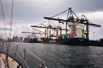
With the storm’s thunder fading out to sea and the rain reduced to a mere drizzle, we enter the Port of Miami. Cuka begins her rain song. I pull off her cage’s cover and she is taking in the sights too. Singing, showing off, and always watching the sky with one eye. Now Phil is at the helm and I am hovered over the paper charts. Trying to tell Phil which visuals to cue up of for the cut over the ICW. Phil is busy piloting between the port’s giant cargo ships and an assortment of water taxis and ferries shooting between Miami and Fisher Island.
And that was the first time our depth gauge started to count down really low. Phil starts reading aloud…4’, 3’, 2’, 1.0’, 0.6 and then 0.0! We both have our eyes glued to the screen and are holding our breath. But we aren’t bumping bottom?! And then I recall reading that you can set “zero” to provide for some “cushion” (since the transducer is actually on the hull and has to be adjusted for whatever the depth of the keel is). But still, it is un-nerving to read zero on the depth gauge, holding what seems to be ancient charts.
We had done our research on the ICW (both USCG website and on-line groups). All votes were that the ICW south of Jupiter was definitely not being dredged as it had several years ago. With more recreational boat traffic and less official ports qualified by Homeland Security, the commercial traffic no longer warrants federal dollars. The feds are not dredging as they used to. In fact, the only reason the ICW was better north of Jupiter is that they take the dredge from the ICW, route it through miles of pipe and discharge it onto the Atlantic coast (thus resanding those hard beaches like Daytona and New Smyrna Beach - see next page). From this point out, we seldom expect depths of more than 10 feet and mostly within 8 foot range. "Slow and steady" is our mantra. And Spun Key is our insurance policy, our personal US Tow should the need arise.
As we come even with the last large cargo carrier dockage, we head southwest into the cut over to south bound ICW. Well, I should say to where the paper chart showed a cut, because just as we turned to enter the mouth of the cut, a US Tow boat speeding by waves at me to come back… into the port. And then, on the VHF we hear him hail us. “Turn around sailboat! That area shallows to only 18” deep!” Phil is hard about and hailing the Port Authority. “Which way for deep draft?” I’m using the sharpie to cross out the cut (seemingly abandoned after some recent hurricane washed silt over its bottom).


